3D Rendering with Drones: Precision and Efficiency
- Alejandro Postigo
- October 29, 2024
- Uncategorized
- 3D, augmented reality, dron, dron integration, drones, drones integration, Integración de Drones, realidad aumentada, Realidad Virtual, render, renderización 3D, Renders 3D, virtual reality
- 0 Comments
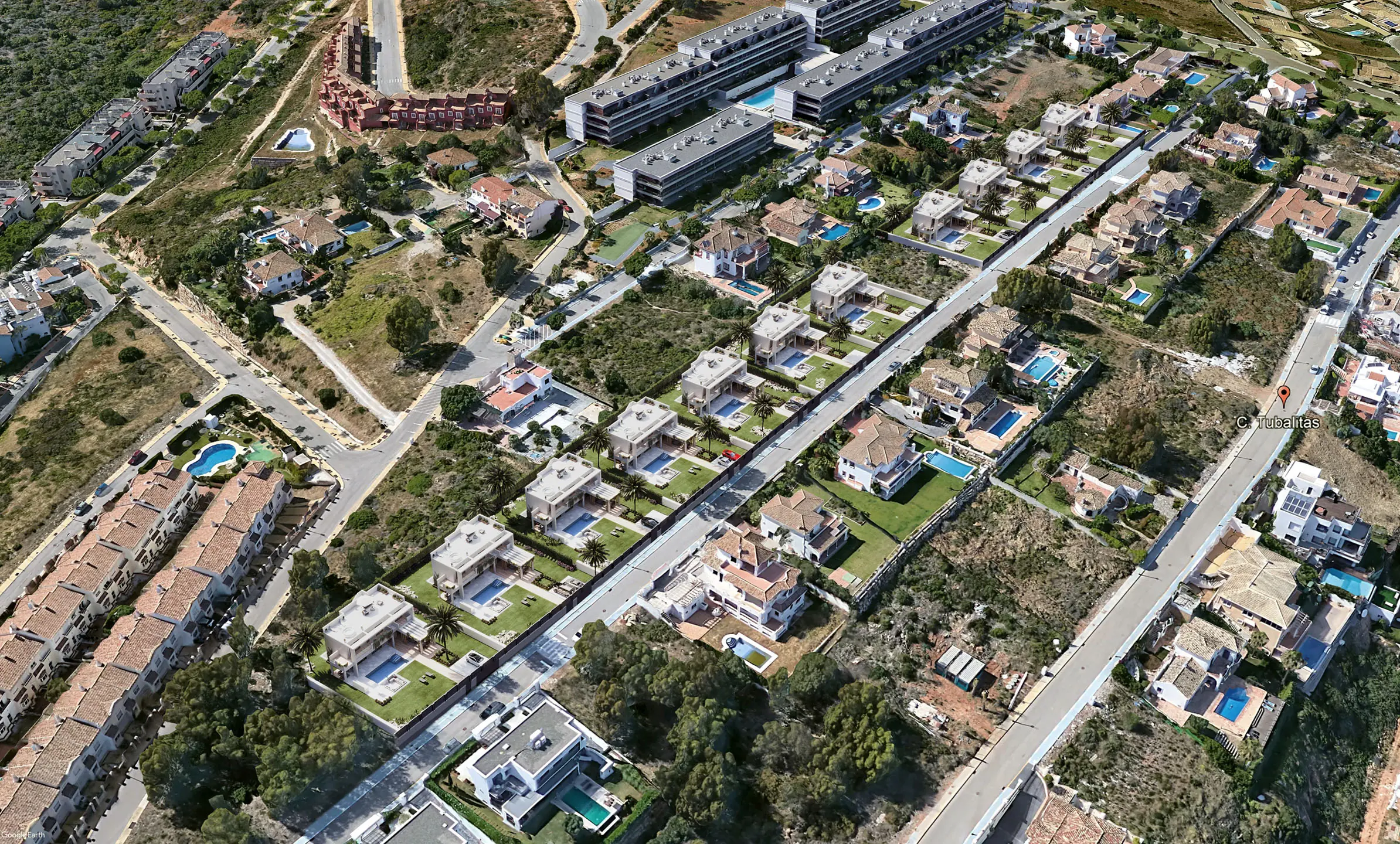
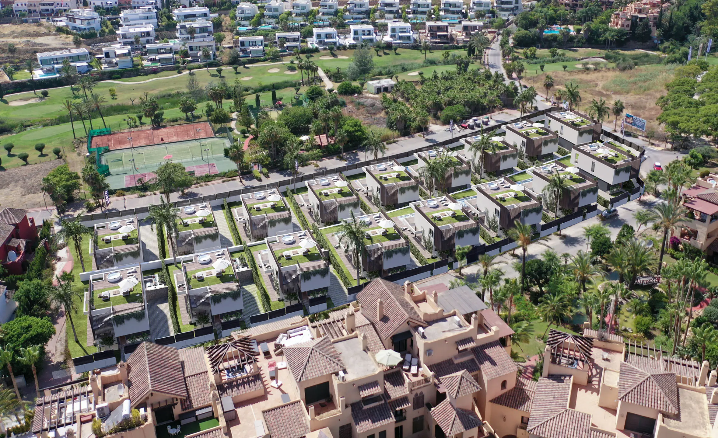
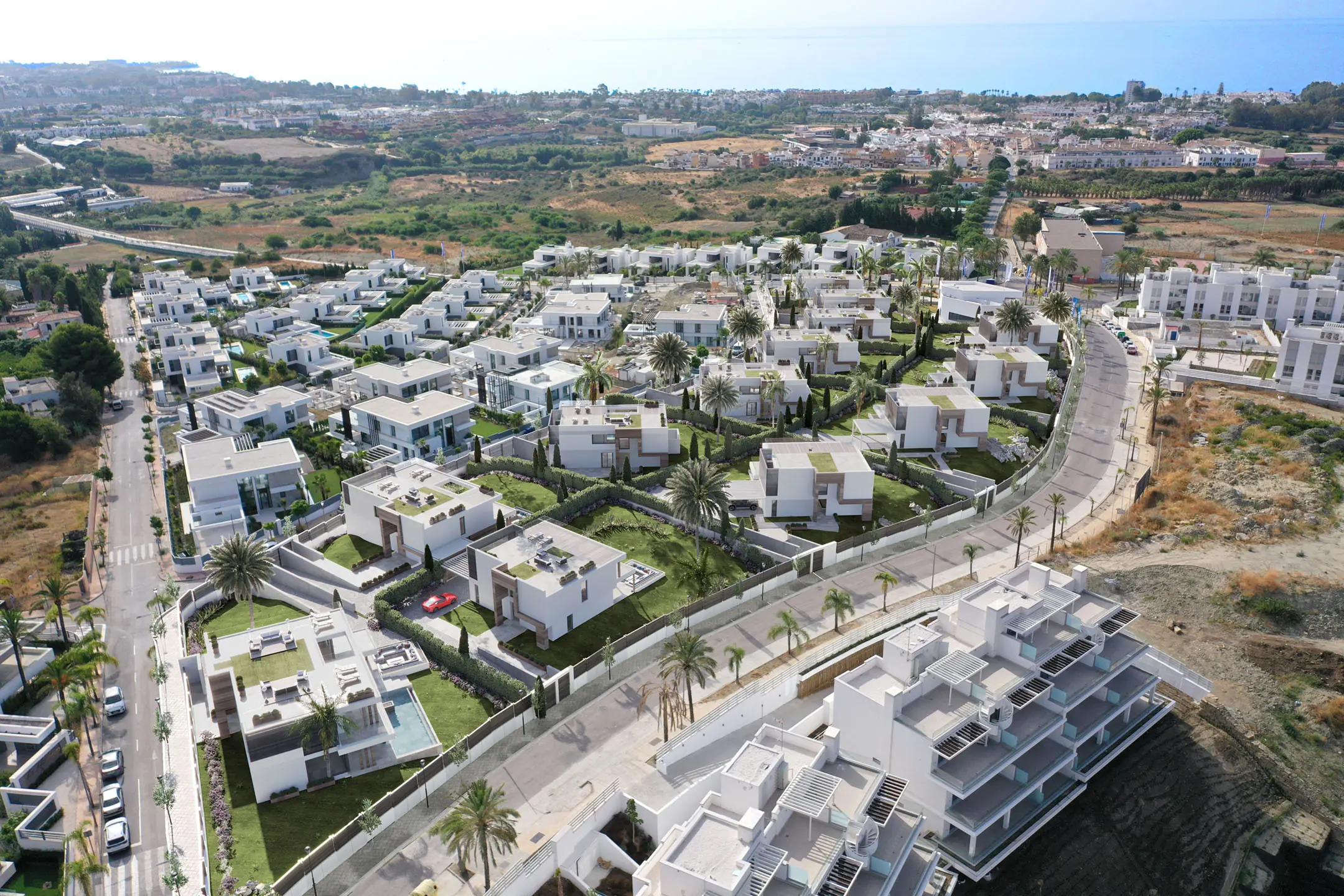
3D rendering has become an essential tool in architectural design, infrastructure planning, and interior visualization. Now, with the integration of drones, this technology has reached a new level of precision, efficiency, and detail. The combination of drones and 3D rendering is transforming the way professionals visualise and execute their projects, allowing them to capture precise data and generate much more comprehensive three-dimensional models.
Read this article: 3D Renders and BIM
Why Use Drones in 3D Rendering?
Drones offer a unique aerial perspective that allows high-quality images and precise data of the terrain and surrounding structures to be captured. This is especially useful in architecture and construction projects, where topographical details and spatial context play a crucial role. Some of the main benefits of integrating drones into 3D rendering include:
- Complete Area Coverage. Drones can fly over large areas, capturing comprehensive views and ensuring that no terrain detail is missed.
- Precision and Realism. Thanks to high-resolution aerial imagery and photogrammetry, drones provide precise data to create detailed, realistic 3D models.
- Time and Cost Savings. By reducing the need for ground-based surveying equipment and minimising human error, drones speed up data acquisition and reduce costs.
Applications of Drones in 3D Rendering
Topographic Surveying for Construction Projects
Drone photogrammetry enables the creation of detailed maps and 3D topographic models of a specific site, which is invaluable for projects that require precise land planning. Drones accurately capture topographic conditions, improving worksite planning and minimising potential complications during construction.
Site Assessment for Renovation Projects
In renovation projects, drones allow teams to visualise the existing structure and capture architectural details, ensuring that the 3D render accurately reflects the building’s real state. This facilitates improvement planning and gives the client a realistic view of how the space would look post-renovation.
Real-Time Project Monitoring and Analysis
During the construction process, drones document project progress with photos and videos that can be integrated into 3D models. This enables architects, engineers, and clients to monitor the worksite in real-time, assess adherence to the initial plan, and make adjustments if necessary.
How is Drone Data Integrated into 3D Rendering?
The process begins with drones equipped with high-resolution cameras capturing detailed images of the location. Through photogrammetry techniques, the software converts these images into a three-dimensional model of the physical space. The captured data is processed in 3D rendering platforms, allowing for additional details, such as textures, lighting, and architectural elements, to be added.
Key steps include:
- Image Capture. The drone conducts pre-programmed flights to capture images from multiple angles and altitudes.
- Photogrammetric Processing. The images are stitched together and processed using photogrammetry software to generate an initial 3D model.
- Integration into Rendering Software. The 3D model is imported into rendering platforms where it can be customised with materials, finishes, vegetation, and other details.
- Client-Optimised Model. The render is adjusted so the client can visualise the project at various stages and in different environments, providing an immersive experience.
Advantages of Using Drones in 3D Rendering Compared to Traditional Methods
The integration of drones with 3D rendering offers several advantages compared to traditional data acquisition methods, such as:
- Higher Precision in Topographic Data. Drone photogrammetry accuracy allows architects and designers to work with highly precise data from the outset.
- Flexibility and Adaptability. Drones can adapt to different terrains and conditions, providing a flexible solution for projects in complex or remote environments.
- Efficient Documentation and Communication. Documenting and communicating construction progress helps teams and clients visualise the project, improve communication, and make real-time decisions.
Challenges and Considerations When Using Drones in 3D Rendering
Despite the many benefits of using drones, there are certain challenges that need to be considered:
- Regulations and Permits. It is essential to obtain permits and comply with local drone flight regulations, especially in urban areas or near sensitive infrastructures.
- Weather Conditions. Factors such as wind and rain can affect capture quality, necessitating careful flight planning.
- Initial Implementation Costs. Although drones reduce long-term costs, the initial investment in technology and software can be high.
The Future of Drones in 3D Rendering
Drone technology is advancing rapidly, and drones equipped with high-precision cameras and sensors continue to enhance data capture for 3D models. In the future, drones are expected to become even more autonomous, improving the precision and detail of 3D renders in a more accessible and efficient manner.
Moreover, the integration of drones with augmented reality (AR) and virtual reality (VR) tools will allow clients to experience 3D projects immersively, offering an interactive preview of the project before construction begins. This evolution will push 3D rendering to new heights, combining cutting-edge technology with visual and functional precision.
The integration of drones in 3D rendering is not only transforming the architecture and construction sectors but also establishing a new standard of precision and efficiency in project design and planning. Thanks to their ability to capture aerial details and convert them into accurate 3D models, drones allow architects, designers, and clients to visualise projects more realistically and in greater detail than ever before. The evolution of this technology promises to take 3D rendering to a new level, redefining the future of architectural design and construction.
Contact us today to find out how we can transform your space into what you’ve always envisioned! Follow us on social media to stay updated.
